
Surfaces in Civil 3D are an important aspect within Civil 3D projects. Most projects require an existing ground to base their designs on and a finished ground as the final solution. There are various tools available to help understand the surface and its terrain – one of them is to drag spot elevation or slope labels around the surface.
Spot elevation and slope labels can be created as needed to annotate a surface. These are dynamic surface labels and not point objects, although they might look similar to points. Slopes can be measured at a single point or interpolated between two points.
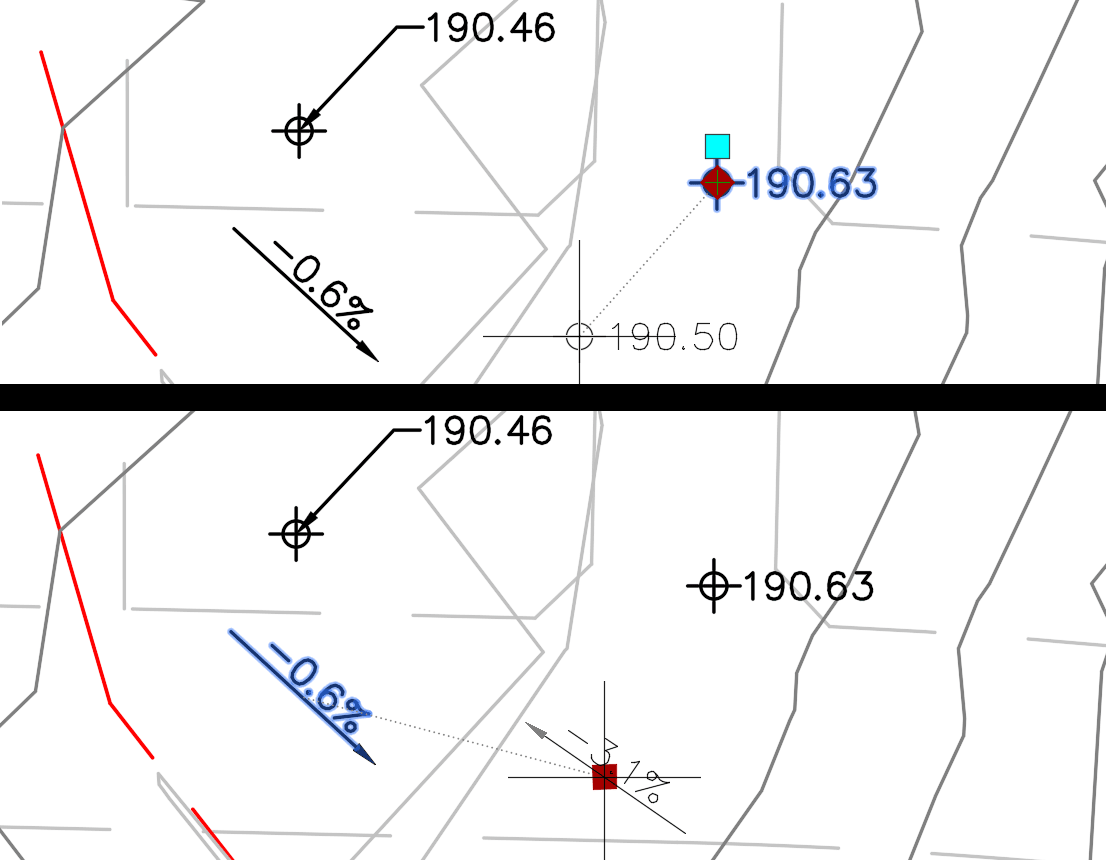
Spot elevation labels can be moved away from the spot symbol (and attached with a leader) or rotated like other standard Civil 3D labels. Spot labels, however, can only be moved, the label component cannot be dragged away from the arrow. 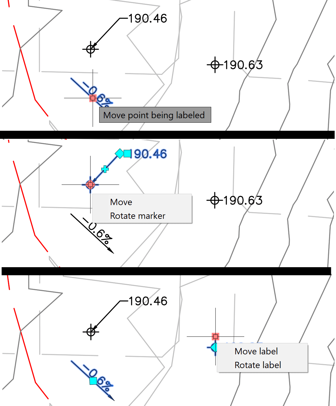
However, when moving either spot elevations or slope arrows, the elevation or slope readings will dynamically update when the elements are being dragged. This can be a handy design tool to assist in inspecting or evaluating surface conditions.
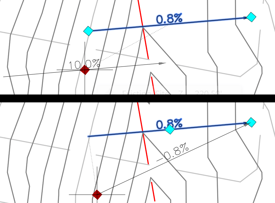
When selecting a two-point slope label, there are three cyan diamond grips, two at the endpoints and one in the middle of the arrow. When selecting the middle grip, you will move the entire label and the reading will update during the dragging. When you select either of the endpoints, you can change the direction, and/or the length of the arrow and the readings of the slope during the dragging.
Conclusion
Civil 3D's dynamic labels for spot elevations and slopes can be a helpful design aid for terrain evaluation. Although you cannot drag and detach the slope label from the arrow, the ability to dynamically observe changes in slope direction and value can greatly enhance terrain analysis.
About the Author
Follow on Linkedin More Content by Jeff Morris


